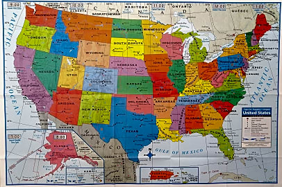
The 10 Best Wall Maps
This wiki has been updated 41 times since it was first published in July of 2015. In addition to serving as excellent educational, logistical or marketing tools, wall maps can look beautiful as decorative pieces in a home or office. In fact, some of these options are legitimate works of art. They can be set up in a classroom to help youngsters with geography or hung up in a den to assist with tracking a bucket list of all the exotic places you intend to visit. When users buy our independently chosen editorial recommendations, we may earn commissions to help fund the Wiki.
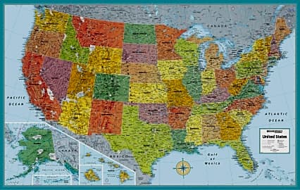
1. Maps International MegaMap

2. Rand McNally Signature
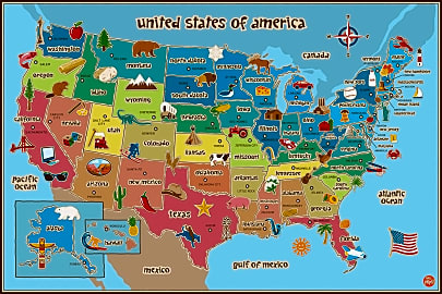
3. Wall Pops USA
Editor's Notes
March 18, 2019:
As an option geared toward children, several things stood out from reports about the Wall Pops USA that led us to up its ranking. Its appearance is simple and bright, and kids seem to genuinely connect with the creative icons associated with each state. The ability to write on it with dry-erase marker makes it an effective teaching tool as well. The Decowall Kids is another nice model for engaging youngsters, but we discovered that the included decals don’t adhere very reliably to certain types of walls, particularly those with a textured finish. For this reason, we dropped it a couple spots. We also slightly demoted the Great Art Retro — though users find it attractive, many complain about the quality of the paper, as it can be difficult to work with and has issues with air bubbles. Removed the Yearainn Vintage and Rand McNally M-Series due to a lack of availability. Added the Kreative Arts Stretch to provide art lovers with an attractive piece to consider, and also added the Moyedecor Original as a more bright and colorful decorative option.
4. Moyedecor Original
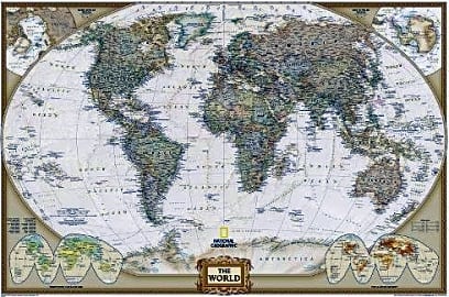
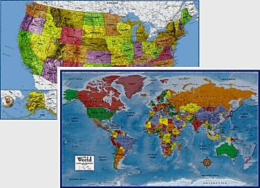
5. National Geographic Executive
6. SwiftMaps Premier Set
7. Kreative Arts Stretch
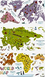
8. Decowall Kids
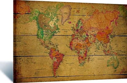
9. Great Art Retro
10. Kappa Superior
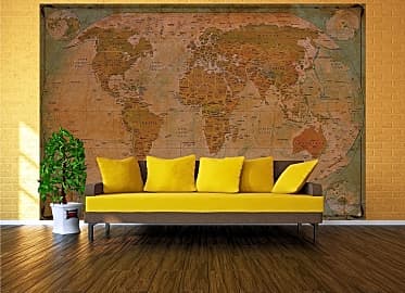
The World On Your Wall
For one thing, a great wall map can cover a lot of real estate, saving you from having to buy many small pieces and coordinate them.
Is there anything that will make you feel like you're living in an asylum faster than staring at a big, white, empty wall? Okay, maybe a straight jacket or window bars, but the point still stands: a blank wall can be unpleasant, institutional even. But don't worry, because we've got the perfect answer to this dilemma — a wall map. Whether you need to decorate a classroom, bedroom, dining room, or just about any other room you can name, the wall map is just the solution to the decorating doldrums.
For one thing, a great wall map can cover a lot of real estate, saving you from having to buy many small pieces and coordinate them. Pop the map on the wall, and boom — instant coverage. Most wall maps start at around three feet by two feet, but some are so large that they'll arrive at your house in sections nearly this size.
Also, consider that a wall map makes a fantastic educational tool for geography classrooms or a child's bedroom. A visual guide to our large and diverse planet, a map can take students on a journey through the cities of the world without ever leaving home. Because your map will likely stay in constant view, it can also be a helpful aid for memorization, whether for capital cities or country names.
A wall map can move easily from educational to inspirational, too. Use colored pushpins to track all the amazing places you've been or where you're planning to go; some maps come attached to a backing that will help you do just this. Add string to show the movement between cities, and you have a wonderful at-a-glance record and reminder of your travels.
Finally, a wall map is an excellent way to bring depth and history to several decorating styles. Anyone with a retro or vintage sensibility, for instance, may appreciate an intricately detailed sepia map, while those going for a modern look might choose a clean, simple version. Pick up the map's colors in your room's accent pieces, such as a clock or pillows, for a pulled-together feel.
Reading A Map
Wall maps may be attractive decorative pieces, but they also have plenty of information to offer, as long as you know how to read them. Fortunately, it's not that difficult, since all you need is a little familiarity with common symbols and markings. We've got a refresher for you here, in case you've forgotten what you learned in geography class.
Near to or within the legend is the scale, which tells the relationship between distance in real life and distance on the map.
The first place to look when you're ready to read a map is the legend — the key to all the symbols on the map — usually located in a box in one corner. Even those with plenty of map-reading skills use the legend, as it offers information that is specific to its map. For instance, a map of the U.S. that shows national monuments will use a particular symbol to represent these, information you can find in the legend.
Near to or within the legend is the scale, which tells the relationship between distance in real life and distance on the map. You're probably familiar with one typical method of representing scale, the ratio (where "1:10,000" might mean one inch on the map equals 10,000 inches in real life, for example), but a map's scale can also be represented graphically. You'll also find that many wall maps, even as they display the whole world, are small-scale maps, those that show large land area in a small and manageable form. A large-scale map of the entire world would probably be difficult to fit in your room.
Many wall maps also show latitude and longitude, which are useful for locating places. Put extremely simply, latitude refers to the imaginary lines that run horizontally around the globe, while longitude specifies those that run vertically. When you know a city's latitude and longitude, expressed as a set of degrees, you can easily find it on your wall map provided it has these lines.
A Brief History Of World Maps
Your wall map is likely a decorative piece or educational tool, which seems simple until you consider that world maps have a long and rich history stretching all the way back to Babylon around 600 B.C.E. The first "Map of the World," which measures a mere three by five inches, doesn't have much in the way of detail, but it does provide an interesting overview of how these ancient peoples viewed their place in the world.
Cartography, the science of map-making, really took off as a discipline with the ancient Greeks and Romans.
Cartography, the science of map-making, really took off as a discipline with the ancient Greeks and Romans. The most famous of these venerable map makers is probably Ptolemy, who literally wrote the book on map-making with his eight-volume masterwork Geography. As you can imagine from its length, this work is highly detailed, containing information about faraway locations as well as instructions for creating maps.
During the Middle Ages, mapmaking became more about representing religious belief than capturing the natural world. Highlighting this spirit well is the famous Mappa Mundi from around 1300 C.E., located in Hereford Cathedral, England. Considered a medieval treasure, this map features Jerusalem at the center and Jesus Christ at its top, which provides a Christian-centric view of the world. It wasn't until after the fall of the Byzantine Empire in the 1400s that Ptolemy's more mathematically focused map-making was rediscovered and revived in the Western world.
Cartography, of course, continued to improve in the following centuries, and today's maps are more detailed and precise than ever thanks to computers, satellite imagery, and the vast array of tools that map-makers have at their fingertips. If your wall map has inspired you to become the next Ptolemy, educational programs are available at a variety or schools and levels of study.


In addition to his corporate career as a marketing and communications professional in Chicago, Sam runs a popular blog that focuses on the city’s flourishing craft beer and brewery scene. He received his degree in journalism from DePaul University (which spurred his interest in freelance writing) and has since spent years developing expertise in copywriting, digital marketing and public relations. A lifetime of fishing, hiking and camping trips has left him well-versed in just about any outdoors-related topic, and over several years spent working in the trades during his youth, he accumulated a wealth of knowledge about tools and machinery. He’s a travel junkie, a health and fitness enthusiast, and an avid biker.