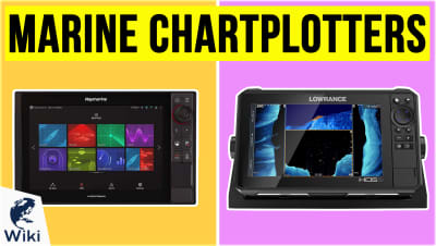
The 10 Best Marine GPS
This wiki has been updated 48 times since it was first published in June of 2015. Don't take your boat out on any serious excursion without a chartplotter qualified for the job. Many newer models support automatic waypoint generation and connect with extremely advanced sonar, GPS, and even GLONASS networks to keep you safe and monitor your ship's systems. These make marine navigation so easy, you'll never have trouble finding that favorite dive spot or fishing hole again. When users buy our independently chosen editorial picks, we may earn commissions to help fund the Wiki.
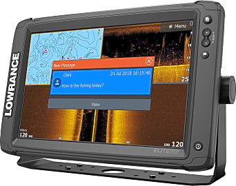
1. Lowrance HDS Live

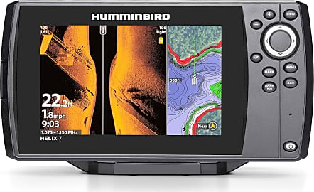
2. Humminbird Helix 5 G2

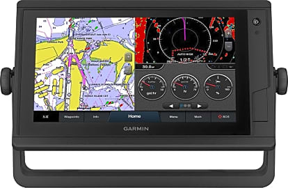
3. Garmin GPSMap 942 Plus
Editor's Notes
November 05, 2020:
Few advancements have made navigating a boat easier than GPS, and the models on this list take that a step further by incorporating useful features such as, depending on the model, fish and depth finders, the ability to control autopilot systems, engine integration, Bleutooth or Wi-Fi connectivity,push notifications, the ability create your own maps, and more.
We made a lot of changes during this update for various reasons. In the case of the Lowrance Hook2-7, we removed it in favor of the Lowrance Hook Reveal 7 SplitShot, which is a newer iteration. The latter has the memory card slot hidden in a more sheltered location, FishReveal and Genesis Live software, what most consider to be improved palettes, and a few other changes that make it a better unit overall. We also added the Elite-12 Ti2 for those who want a 12-inch display but for about half the cost of most other models with relatively comparable features.
The discontinued Garmin 1040xs is another model that was removed from our list. It was replaced by the Garmin GPSMap 942 Plus, which has a 1-inch smaller display, but with touchscreen functionality. It is also preloaded bluechart G3 coastal charts and LakeVü G3, whereas the 1040xs had the older version of both map databases.
Another change was replacing the Garmin Echomap Plus 74Cv with the Garmin EchoMap UHD 74Cv, the latter of which offers a enhanced resolution due to its better sonar technology, and also comes with the newest coastal maps. Additionally we eliminated the discontinued Simrad GO7 XSE in favor of the Simrad GO7 XSR, which has similar specs but a notable difference in that it is radar capable.
Some other changes include eliminating the Garmin Striker 7sv, which had very limited GPS capabilities, and the Garmin Striker 4, which simply had too small of a screen for a mounted option.
May 22, 2019:
GPS units are just as important, if not more so, on the water as on land. Whether you need one to mark favorite fishing and dive spots, navigate your way to a new port, or simply to track your vessel speed, the information they provide will come in handy when boating. These days, they are capable of so much more than simply telling you which direction to go. For example, the Lowrance HDS Live can make piloting your vessel safer. Once programmed with your boat's information, such as draft, height, and beam, it will automatically create a route to your destination that avoids any potential trouble spots. The Simrad Go7 XSE, Garmin Echomap Plus 74Cv, and Raymarine Axiom 7 all feature a touchscreen interface for convenient operation and produce high-quality images of underwater structures, while the Garmin 1040xs features a split screen mode that allows you to view two different data sets simultaneously. For those with smaller vessels, we have included the handheld Garmin 78S and compact Garmin Striker 4. If you are worried about future issues with your device, you'll appreciate the five-year upgrade policy on the Lowrance Hook2-7. Even when it goes past its one-year warranty, the company will allow you to buy one of their new GPS units for half-price if your current one breaks. Except for the Garmin 78S, all of the rest of the units on our list also double as depth and fishfinders.
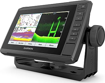
4. Garmin EchoMap UHD 74Cv
5. Humminbird Helix 7 CHIRP MSI
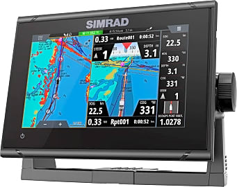
6. Simrad GO7 XSR
7. Elite-12 Ti2
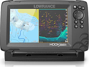
8. Lowrance Hook Reveal 7 SplitShot
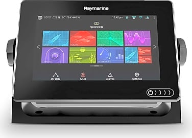
9. Raymarine Axiom 7
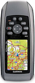
10. Garmin 78S
The History Of GPS Navigation
This motivated the United States to allocate more money towards their own satellite project and, in 1960, the US launched their first satellite system known as Transit.
The Global Positioning System (GPS), was originally created for military and government intelligence applications. It is a network of satellites that orbit the Earth in fixed points and beam signals down to anyone using a GPS receiver, no matter where on the planet they are located.
In 1957 just as the cold war was becoming more intense, the Soviet Union launched Sputnik, the world's first artificial satellite. This motivated the United States to allocate more money towards their own satellite project and, in 1960, the US launched their first satellite system known as Transit. Transit consisted of five satellites and allowed US Navy ships to take a reading on their position once every hour.
In 1967, Transit was replaced by the Timation satellites, which featured extremely accurate atomic clocks. The more accurate a satellite's clock, the more accurately it can determine a GPS receiver's location. Between 1978 and 1985, GPS technology experienced rapid development with a total of 11 new satellites being launched.
When the Soviet Union shot down a Korean passenger jet in 1983, the Reagan Administration decided that GPS was needed for civilian applications as well. This would allow them to accurately determine their location and reduce the possibility of straying into a restricted foreign territory.
In mid 1993, the US launched their 24th Navstar satellite thus completing the modern 24 satellite GPS. At any given time 21 satellites are used to fix a GPS receiver's location while three satellites are spares in case one of the satellites malfunctions. Currently, the European Union is creating the Galileo GPS system which will use a total of 30 satellites, 14 of which are already in orbit.
Why Navigation Is So Important At Sea
Marine navigation is making the marine transportation world safer and more efficient. It is easy for landlubbers to believe that GPS navigation is only a necessity when large ships are out at sea with no land in sight to use as a reference, but this isn't true. GPS make navigating congested waterways and harbors safer. In fact, GPS navigation is more critical as large ships pull into port, when the risk of crashing into other ships and hazards is elevated.
In fact, GPS navigation is more critical as large ships pull into port, when the risk of crashing into other ships and hazards is elevated.
When looking at the numbers, it is easy to see that GPS navigation has made the seafaring world safer. Between 1994 and 2010, as the use of GPS became a standard on most ocean going vessels, the total loss of ships over 500 gross tonnage has come down from 180 per year to 60 per year. High value accident claims have reduced from 520 a year in 1990, to 200 a year in 2010. And perhaps most importantly, the number of lives lost at sea annually has decreased from 450 in 1995 to 250 in 2010.
Environmental repercussions have lessened as well. The use of GPS is also responsible for reducing the amount of oil spilled at sea as a result of vessel crashes. In the 1970s, there was an average of 22 major oil spills a year from ships and, in 1993, roughly 140 million tons of oil was spilled from ships. In 2011, only 1,000 tons of oil was spilled. This increase in safety and lessened environmental impact has come even as ocean trade continues to grow.
Picking A Marine GPS System
Marine GPS units come in all shapes and sizes, which can make picking the right one difficult for those new to using them. Before choosing any GPS unit, it is best to consider a few important factors. First check the manufacturers specifications to see how many satellites the device uses. Low cost models may only use 12 satellites, which is enough to function properly, but a 24 satellite system will be notably more accurate.
Larger mounted GPS receivers are good for those who like looking at a large, color screen and want to see a lot of details about the surrounding area.
Next, one should consider if they prefer a handheld unit or one that gets mounted to the boat's dash. If you have a small John boat or dinghy, a handheld model is probably sufficient. But it can be difficult for some to read the screen of smaller units and they also generally have reduced mapping capabilities.
Larger mounted GPS receivers are good for those who like looking at a large, color screen and want to see a lot of details about the surrounding area. Many are also compatible with a fish finder and depth sounder. Those with sailboats and larger yachts that carry a dinghy will often require both types. The handheld model being vital in an emergency when the larger vessel must be evacuated.
Depending on how you want to add new maps to your unit, you may want a model that can be connected to a computer. This allows one to download new maps and transfer them directly to the internal memory of their GPS. Models that don't connect to a computer will require the user to buy cards which have maps of particular regions of the world.
Some marine GPS systems, particularly handheld models, are considered non-mapping. This means they show a compass, latitude, and longitude to help you determine your position, but not an actual map. If you want to see a map displayed on the screen, choose a mapping system.


A wandering writer who spends as much time on the road as in front of a laptop screen, Brett can either be found hacking away furiously at the keyboard or, perhaps, enjoying a whiskey and coke on some exotic beach, sometimes both simultaneously, usually with a four-legged companion by his side. He has been a professional chef, a dog trainer, and a travel correspondent for a well-known Southeast Asian guidebook. He also holds a business degree and has spent more time than he cares to admit in boring office jobs. He has an odd obsession for playing with the latest gadgets and working on motorcycles and old Jeeps. His expertise, honed over years of experience, is in the areas of computers, electronics, travel gear, pet products, and kitchen, office and automotive equipment.